
This article was originally published on July 1, 2011, in the Shenzhen Daily.
The information was accurate at that time, and may be outdated now. Use with caution.
The information was accurate at that time, and may be outdated now. Use with caution.
NOTE: This article is now, essentially, history. In November of 2013, a new terminal was opened. Passengers arriving by Metro are now required (I'm told) to take a shuttle bus to reach the new terminal. If one rides to Airport East, the shuttle takes about 25-30 minutes; savvy travelers will take the shuttle from Hourai Station, an 8-10 minute ride. Ah, progress.
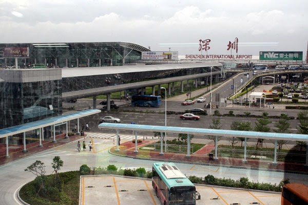 |
| Pedestrian bridge from the Metro station to the airport terminals |
First: Shenzhen Airport, via Lines 5 and 1.
In recent days, the Shenzhen Daily has reported a few problems with the newest lines and extensions. However, like the overwhelming majority of passengers, my rides and transfers went smoothly, and the new train cars were a delight to ride in.
I transferred from Line 5 to Line 1 at Bao'an Center. I found the signage clear, and I had no problem moving quickly from one train to another. The train emerges from underground between Gushu and Hourui Stations.
 |
| The Metro station as seen from the pedestrian bridge |
 |
| The Metro station as seen from Terminal A |
 |
| Terminal A as seen from the pedestrian bridge |
Overall, my experience in taking the Metro to the airport has me looking forward to the next time I fly.
GPS Info:
- 22.64738, 113.82271
Map:
No comments:
Post a Comment